 |
| Female lesser purple emperor resting on our basil seedlings |
THURSDAY 26 MAY
Thursday started lovely and sunny but by the time we left at
9.00am it had clouded over and stayed that way until mid-afternoon. It was one of those breezy days when it wasn’t quite
warm enough for a tee-shirt when standing on an open boat for hours on end, but
a fleece was too much. Karen walked down
to the opposite side of the European parliament building while I cast off. The plan had been for her to get a cheeky picture
of the boat with the union jack part of our red ensign in full view in front of
the building.
The trouble was as soon as I set off, I seemed to be surrounded by
rowers and then a trip boat started bearing down on me so there was no way I
was going to manoeuvre safely in front of the building let alone hold the flag
out. This was compounded by the fact that to get completely in front of the building meant turning up one of the sections closed to private boats. Maybe we’ll have another go on the way back.
 |
| The best we could do |
After picking Karen up we worked our way around Strasbourg until we joined the canal du Rhône au Rhin that would take us south. On the way we went through one of the large ship basins and also the port for private boats. We couldn’t believe the number of boats still in the port and also the fact that there were very few spaces available as we know of a few large (20+ metre) boats that overwintered there and have now gone cruising for the season. We were quite glad we’d moored where we had as the port was just as far from the centre of the city as it was from our mooring at the parliament building. Mind you, it must be a great place to overwinter with so many other people there, especially those that enjoy socialising.
 |
| Turning into the Bassin des Remparts |
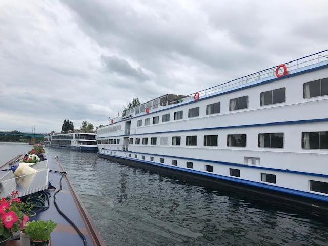 |
| A couple of Rhine river cruisers getting ready for their next guests |
Leaving the larger waterway behind we joined the Rhône au Rhin which didn’t even have the customary welcome sign at the start of a new waterway just an aging VHF channel indicator for the canal.
.jpeg) |
| Only indication we were entering a new canal |
The canal was built in the late 1700s and used to run parallel to the Rhine from Strasbourg for around 135 km up to Mulhouse. The correct name for the canal is the Rhône au Rhin branche nord. The Rhône au Rhin proper runs from Mulhouse down the Doubs valley to Saint-Symphorien on the river Saône. Only the top 35 km or so of the branche nord are now in use and when boats reach the end, they have to join the Rhine to get up to Mulhouse to get onto the canal du Rhône au Rhin main line. There have been plans to restore the disused section but there are continuing budgetary issues which are not expected to be resolved. Over the next few days, we’ll be going up to the current end of the canal at the Rhine junction and then returning to Strasbourg.
 |
| Red line = canal du Rhône au Rhin branche nord |
When looking at the guidebooks for the canal the first reaction is that it must be very boring as it’s almost dead straight for 30 km. We know of people who haven’t gone on it for that very reason and it almost put us off too. In fact, everyone we know who has been on it has used it as a means of bypassing the Rhine around Strasbourg. In the end we were glad we persevered because it’s a very pretty and rural canal running along the wide expanse of the Rhine floodplain. To the west are the mountains of the Black Forest and to the east, the Vosges mountains of France.
 |
| A couple of the pages showing the canal with the Rhine to its right |
The lock cottages were quite different to the styles we’ve seen on other canals and with their tile hung fronts looked almost Wealden rather than the austere or plain looking cottages we’re used to seeing. There were no control huts for the éclusiers which is where the intercoms are normally attached for boaters to call VNF when they need to request assistance. Because of this, the intercoms were placed by the front doors of the cottages which felt quite intrusive as they would mainly be privately owned nowadays.
 |
| Different style of lock cottage |
 |
| Intercom and information point by a front door |
We only had to call VNF once and that was after a hire boat hadn’t waited for the gates to fully open before exiting a lock so consequently the lock went out of action indicated by the displaying of a pair of red lights. Karen went off to use the intercom and at that particular lock it was in the porch of the turquoise blue one above which felt even more intrusive than if it had been on the outside wall.
Much of the route was lined with large plane trees which must provide
welcome shade on hot days. They weren’t
as welcome for us though as they kept off what little sun there was. We didn’t really expect to see any boats but an
éclusier, who welcomed us to the canal at the first lock to take all our
details, told us there was a small hire boat base and we did pass three hire
boats during the day. It seemed a
strange canal to have a hire boat base as they wouldn’t be allowed on the Rhine,
and it would take them a good few hours to reach Strasbourg.
 |
| Lovely old plane trees |
Every so often there were open sections for a few hundred metres and in some of these, old péniches had gathered to see out their days converted to permanently moored liveaboards. We always say we’d love to see around one of these conversions as there must be so much space and therefore scope for designing quite stunning accommodation. We stopped for lunch at one of the open stretches just above the lock at Schafhardt. We were alongside a golf course, the first we’ve seen over here and funnily enough we'd recently been discussing the reasons for an apparent paucity of golf courses in France.
It was a bank holiday in France and one of those taken more
seriously as most shops and offices were closed. Many people take the Friday off too thus making it
into a long weekend and we saw families cycling along the well-made
towpath with their bike trailers full of camping gear. Some were just out for the day and had taken food
and drink and set up elaborate table settings on picnic tables along the route. We've never felt so much in the limelight with people taking photos and videos of us, many were very polite and asking first. I have to admit that after being on the canal for a few days, Karen's estimate of 80% of people stopping to take pictures was probably about right.
At one point we had to cross the river Ill, one of the rivers that
flows through Strasbourg. Rather than
crossing on an aqueduct, the canal and river form a crossroads, so care had to be taken
to counteract the cross current which fortunately was quite benign when we
crossed.
 |
| Crossing the Ill |
The canal became quite remote once leaving Strasbourg with very few settlements and consequently very few moorings. We felt that we would be safe mooring with pins above a lock as there was so little traffic and ended up doing just that at a place called Gerstheim. While tying up Karen found an old ring hidden in the grass, so we made use of that at one end of the boat. By that time the sun was out, and we had a lovely warm end to the day with pleasant views across to the Black Forest mountains in the far distance.
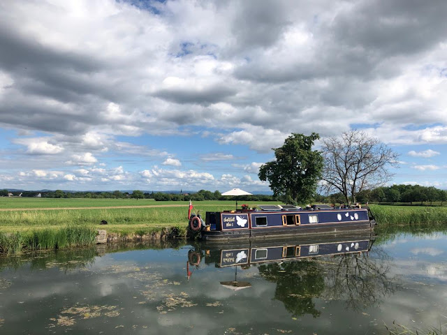 |
| Moored at Gerstheim |
On Thursday we cruised 27 km up nine locks through one lift bridge.
FRIDAY 27 MAY
We continued our dead straight journey up the northern branch of
the Rhône au Rhin on Friday morning.
Between two of the locks the original poles for carrying the overhead
electric cable for the towing locos were still standing along the bank. I know I’ve mentioned many of the vestiges of
this bygone era before but surprisingly this is the first time we’ve seen the
poles.
The canal used to run almost dead straight for the 135 km up to
Mulhouse but is now abandoned for the last 100 km. Where the abandoned section started, a three
to four km link had been built at right angles to join the Rhine (see map
above). Once we turned off onto the
branch to the Rhine, the nature of the canal completely changed.
.jpeg) |
| More like riverbanks |
A road crossed on a bridge near the end, and as we approached it, I thought I saw a VNF van going over. As we went under the bridge, I could see a van parked on a track and an éclusier standing on the bank, so I slowed down as it looked like he wanted to chat. It turned out that he just wanted to know if we were going on the Rhine as he would have had to operate the lock onto it for us. I explained that we were going to reach the end and then turn around - I think he thought we were mad. Reaching the end, we spun around and moored up opposite some dingy looking cruisers in a sad looking boat yard.
 |
| Moored at the end |
After checking around the immediate area we shut the boat up so we could have a walk along the Rhine. Walking by the lock that opens onto the river from the canal we noticed it had sliding doors instead of hinged or guillotine gates or even those strange semi-circular ones that rise from the bottom. Thinking about it we realised that this was because the water level of the river would sometimes be lower than that of the canal and at other times higher; sliding gates would cater for both circumstances. When we’ve come across this situation before, pairs of hinged gates have been used that open in opposite directions. The operator would then select the pair of gates appropriate to the water level.
 |
| Sliding lock doors |
Arriving at the Rhine we could see we were in a canalised section and to be honest the flow didn’t look too bad, but we were sure we’d made the correct decision not to join it. We always marvel at the engineering feat of canalising a river and this was no exception here, especially considering the height difference that has to be allowed for either side of the locks which are all 13 to 15 metres deep.
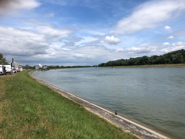 |
| Arriving on foot at a canalised section |
We weren’t too far from a lock alongside one of the hydroelectric plants installed on the weirs along the river so went up to see how close we'd be allowed to get.
 |
| Hydroelectric plant at Rhinau opened in 1963 |
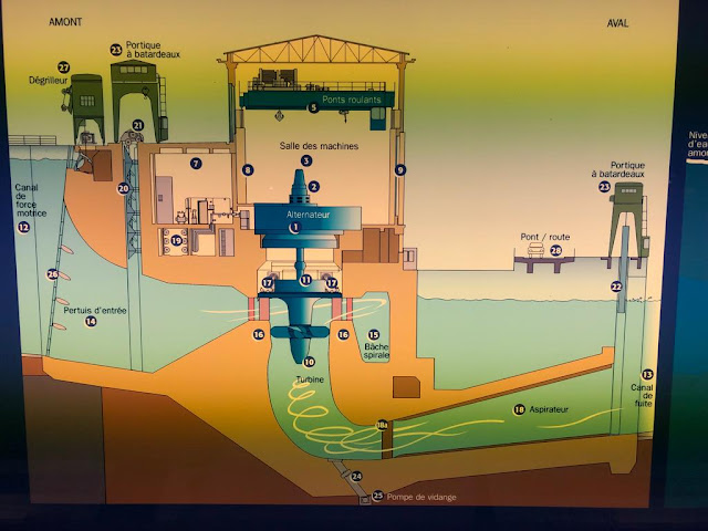
Surprisingly we were allowed to walk across the weir right up to the plant and, following some narrow steps, climbed up beside the building to see if we could get access to the lock. At the top there was a padlocked gate into the lock area but also what looked like an unused door into the building. Karen tried the handle and to our surprise it opened, and we entered a gallery overlooking the power plant. Along the wall were posters explaining about hydroelectric power and the history and development of navigation on the Rhine.
I’ve never really thought about the mechanics of how
hydroelectricity is generated but there was a simple diagram on display that
really helped us.
Looking down from the gallery, four alternators could clearly be
seen. We assumed only two were in
operation as when we’d walked across the weir there were only two major
outflows, the sluices for the other turbines being shut off.
 |
| The four alternators |
We then managed to get across to the locks which are built in pairs on the Upper Rhine. Both are 185 metres long, but one is 12 metres wide and the larger one 23 metres. We have only been in the 185 x 12 metre locks in France which seem to be the standard size on many rivers. The locks on the Rhine are open 24 hours a day and a boat was just entering the smaller lock when we arrived.
At twice the length of the péniches we come across on the canals
this boat, at 80 metres, was still a baby as two of them would have easily fitted
in the lock together. After watching the
boat tie up, we continued across the locks so we could set foot in Germany for
a few minutes. Walking back to the canal
we saw a larger, fully laden boat heading upstream for the lock that was about
to be vacated. According to one of our
boat tracking apps it was the 105-metre German registered Wendelin on its way
to Basel.
 |
| Wendelin |
Back at the boat we harvested some cherries from one of the many cherry trees that can be found along the canal and then set off. We wanted to return to Gerstheim where we’d stopped over on Thursday night as it was in a peaceful open section with wonderful views to the Black Forest mountains one way and the Vosges mountains the other.
Not only were there cherry trees in great abundance but there were also a lot of walnut trees although the fruits were still not large enough to pick for pickling. Insects were in abundance too with an amazing number of butterflies and dragonflies especially along the section onto the Rhine. We saw four new species of butterfly for the year including a lesser purple emperor that took a great interest in the burgundy sections of our roof as well as our flowers.
 |
| No comments about the paintwork please! |
With the dry winter and spring, water cannon are already being used on the crops along the plain and we were sprayed a couple of times as we cruised along! We reached our mooring just as the locks were closing for the day at five o’clock. Before we tied up just above a lock we spun the boat around first as we’d passed the pully pole and would need to go back to pull it when we left on Saturday.
On Friday we cruised 24 km up two locks and down two locks.
SATURDAY 28 MAY
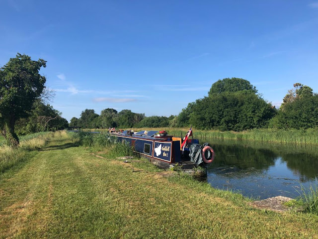 |
| Saturday morning at Gerstheim |
When Karen took Buddy out for his pre-breakfast walk, she had two lucky finds, a Michelin sign for the canal...
…and towing loco tracks on a bridge:
We had a leisurely start as it was Saturday and had one of those
journeys where the sun alternated between being fully out and completely
clouded over. Our first target was to
reach the VNF yard at Krafft where we hoped to take on water. The plane trees were more welcome on the journey this time,
especially when the sun was out.
 |
| Not so tall as the previous day’s avenue |
When we arrived at the VNF yard it was closed up and so were the offices but there was one éclusier on duty sitting at a picnic table. He was on call for the day and was happy we’d arrived as it relieved the monotony of playing on his phone while waiting for a call that might never happen. He helped us tie up and then fetched the hose for us. I know Karen won't be happy I'm mentioning something personal but there's something extra relaxing about being hooked up to water. Not only can we get the washing done but we can have long showers knowing full well that we'll still be leaving with a full water tank.
The VNF yard was one of those moorings that was fully secure overnight and at weekends and would be a great place to stay for boaters not bothered about getting out. While we were topping up, the éclusier received a call, moved his car next to our boat (we've no idea why) and disappeared off in his van presumably to help someone out.
We carried on to a place called Schlafhardt where there was a pleasant mooring just above a lock, so we stopped for the day.
 |
| At Schlafhardt |
After lunch we had a walk to Illkirch-Graffenstaden, a modern suburb of Strasbourg. If you count walking down one side of the canal and back up the other as part of a circle, it was actually a circular walk in that we didn’t repeat any steps along the way.
 |
| Unusual method of mooring at Schafhardt |
On Saturday we cruised 13 km down four locks.
SUNDAY 29 MAY
A decidedly cooler morning greeted us on Sunday which was welcome
as we’d planned a nice easy day. After a
late breakfast we went for a walk around a lake with the idea that we would
then walk through some parkland and then around another lake. When we reached the parkland, it turned out
to be a pitch and putt course linked with the golf course I mentioned earlier
so we had to give up on the idea of walking through it. We went in search of the second lake by
another route only to find that it was still a working gravel pit and therefore
had no public access. We ended up
returning to the boat after walking around part of the first lake again. The weather slowly improved during the day
and by mid-afternoon it had warmed up and we had clear blue skies presaging the
forecast return of sunny days with temperatures in the high 20s.
Much of the day was spent researching the time we’ll spend
cruising in Germany and Luxembourg when we’re travelling on the river Sarre and
then the Moselle in a few weeks. We had
to do things like find out how to receive alerts from the respective authorities
about navigational incidents and planned outages.
Other important tools included downloading apps that provide the current
state of the water levels and flows on the rivers at various points on the
route. It’s going to get confusing as to
which language we shall use when spelling things, for example the Sarre is Saar
in both German and English. The Moselle
is the same in English but Musel in Luxembourgish and Mosel in German. I think we’ll probably stick with the French
names as far as the blog is concerned.
Before we hit the river Sarre in Germany we’ve got to get back
through Strasbourg, retrace some of our steps along the Marne au Rhin, go up
the inclined plane again and then turn onto the canal de la Sarre which will be
yet new territory for us. We will travel
the length of the canal de la Sarre until we join the river shortly after
entering Germany.


.jpeg)
.jpeg)

No comments:
Post a Comment